About Lamongan
Lamongan is a stratovolcano rising to 1,641 meters (5,384 feet) in Indonesia's Sunda-Banda Volcanic Regions. Its last known eruption was in 1898 CE. The volcano has produced 20 recorded eruptions, with a maximum Volcanic Explosivity Index (VEI) of 3.
Geography & Climate
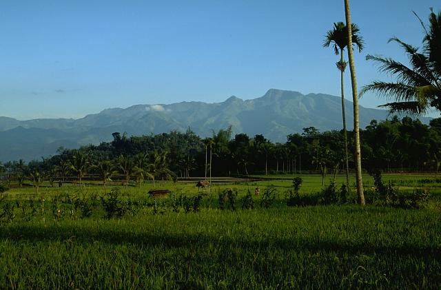
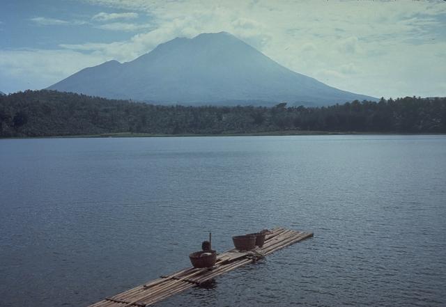
Lamongan is located in Indonesia, within the Sunda Volcanic Arc of the broader Sunda-Banda Volcanic Regions. Situated at 7.98° S, 113.34° E in the Southern Hemisphere, the volcano lies within a tropical climate zone. With a summit elevation of 1,641 meters above sea level, Lamongan is a moderately sized peak that remains accessible to hikers and researchers for much of the year. The volcanic landform is characterized as a composite, which describes the physical shape and structure of the volcanic edifice as observed from the surface.
Geological Context
Lamongan sits in a subduction zone, where one tectonic plate dives beneath another, creating intense heat and pressure that generates magma. Subduction zones are responsible for many of the world's most explosive volcanoes and deadliest eruptions. For communities in Indonesia near Lamongan, this tectonic setting means the volcano is capable of producing powerful explosive eruptions, pyroclastic flows, and lahars that can threaten populated areas within tens of kilometers of the summit. The dominant rock type is basalt / picro-basalt, a dark, fine-grained volcanic rock that forms from rapidly cooling, low-viscosity lava. Basaltic eruptions tend to be less explosive and produce fluid lava flows that can travel long distances. While less immediately dangerous than explosive eruptions, basaltic lava flows can destroy structures and infrastructure in their path, and volcanic gases released during these eruptions can affect air quality over a wide area.
Eruption History Summary
Lamongan has 20 recorded eruptions in the geological database, spanning from 1869 CE to 1953 CE. The most powerful recorded event was a severe eruption capable of regional ash fall and pyroclastic flows in 1877 CE, reaching VEI 3 on the Volcanic Explosivity Index. With an average interval of roughly 4 years between eruptions over a span of 84 years, this is one of the more frequently active volcanoes in the database. This persistent activity suggests a robust and well-supplied magma system beneath the volcano. The most recent eruption in 1953 CE places this volcano within the modern era of volcanological observation.
Significance
With a maximum recorded VEI of 3, Lamongan has produced eruptions capable of generating pyroclastic flows and significant ash fall in the surrounding area. While not among the largest eruptions globally, VEI 3 events pose serious hazards to local populations and can disrupt regional air travel. Its 20 recorded eruptions make it one of the most prolific volcanoes in our database, reflecting a persistent and well-documented eruptive history that has provided volcanologists with extensive data for understanding eruption patterns and forecasting future activity. Given its recent activity, Lamongan is closely monitored by geological survey organizations to provide early warning of future unrest.
GVP Reference Summary
Lamongan, a small stratovolcano located between the massive Tengger and Iyang-Argapura volcanic complexes, is surrounded by numerous maars and cinder cones. The currently active cone has been constructed 650 m SW of Gunung Tarub, the volcano's high point. As many as 27 maars with diameters from 150 to 700 m, some containing crater lakes, surround the volcano, along with about 60 cinder cones and spatter cones. Lake-filled maars, including Ranu Pakis, Ranu Klakah, and Ranu Bedali, are located on the E and W flanks; dry maars are predominately located on the N flanks. None of the maars has erupted during historical time, although several of the youthful maars cut drainage channels from Gunung Tarub. The volcano was very active from the time of its first historical eruption in 1799 through the end of the 19th century, producing frequent explosive eruptions and lava flows from vents on the western side ranging from the summit to about 450 m elevation.
— Smithsonian Institution, Global Volcanism Program
20 Recorded Eruptions
| Year | VEI | Type | Area |
|---|---|---|---|
| 1953 | 2 | Uncertain Eruption | — |
| 1898 | 2 | Confirmed Eruption | SW flank 400 m (Mt. Anyar) |
| 1896 | 2 | Confirmed Eruption | — |
| 1893 | 2 | Confirmed Eruption | — |
| 1891 | 2 | Confirmed Eruption | — |
| 1890 | 2 | Confirmed Eruption | — |
| 1890 | 2 | Confirmed Eruption | — |
| 1889 | 2 | Confirmed Eruption | — |
| 1888 | 2 | Confirmed Eruption | — |
| 1887 | 2 | Confirmed Eruption | — |
| 1887 | 2 | Confirmed Eruption | — |
| 1885 | 2 | Confirmed Eruption | — |
| 1884 | 2 | Confirmed Eruption | — |
| 1883 | 2 | Confirmed Eruption | — |
| 1877 | 3 | Confirmed Eruption | — |
| 1874 | 2 | Confirmed Eruption | — |
| 1872 | 2 | Confirmed Eruption | — |
| 1870 | 2 | Confirmed Eruption | — |
| 1870 | 2 | Confirmed Eruption | Summit and SW flank |
| 1869 | 2 | Confirmed Eruption | Summit and south slope |
Real-Time Data
Frequently Asked Questions About Lamongan
Is Lamongan an active volcano?+
Lamongan is classified as active based on credible evidence of past eruptions. Although its last known eruption was in 1898 CE, volcanologists consider it capable of erupting again.
When did Lamongan last erupt?+
The most recent recorded eruption of Lamongan occurred in 1953 CE with a Volcanic Explosivity Index (VEI) of 2. The eruption was classified as a "Uncertain Eruption." Lamongan has 20 recorded eruptions in total.
How high is Lamongan?+
Lamongan has a summit elevation of 1,641 meters (5,384 feet) above sea level. At 1,641 meters, it is a moderately sized volcanic peak, roughly comparable to Mount Vesuvius (1,281m).
What type of volcano is Lamongan?+
Lamongan is classified as a Stratovolcano. Stratovolcanoes (also called composite volcanoes) are steep, conical volcanoes built up by many layers of hardened lava, tephra, and volcanic ash. They are among the most common and dangerous types, known for explosive eruptions.
Where is Lamongan located?+
Lamongan is located in Indonesia, in the Sunda-Banda Volcanic Regions. More specifically, it lies within the Sunda Volcanic Arc. Its exact coordinates are -7.981° latitude, 113.341° longitude.
Is it safe to visit Lamongan?+
Lamongan can generally be visited, but as with any volcano, visitors should check local conditions and any advisory notices before traveling. Indonesia may have specific regulations for accessing volcanic areas. Guided tours are often the safest and most informative way to experience a volcano.