About Wilis
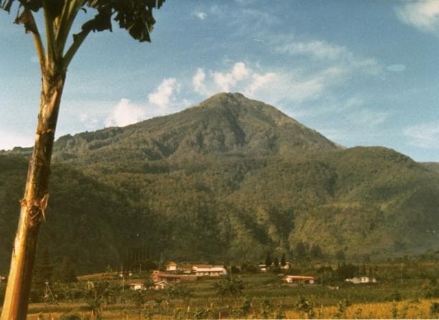
Wilis is a stratovolcano rising to 2,563 meters (8,409 feet) in Indonesia's Sunda-Banda Volcanic Regions. No historical eruptions have been recorded, though the volcano is classified based on geological evidence of past activity.
Geography & Climate
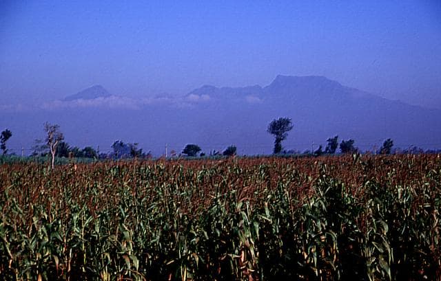
Wilis is located in Indonesia, within the Sunda Volcanic Arc of the broader Sunda-Banda Volcanic Regions. Situated at 7.81° S, 111.76° E in the Southern Hemisphere, the volcano lies within a tropical climate zone. At 2,563 meters above sea level, Wilis rises above the surrounding terrain into montane or subalpine conditions. The elevation creates distinct ecological zones along its flanks, from forested lower slopes to exposed rocky terrain near the summit. The volcanic landform is characterized as a composite, which describes the physical shape and structure of the volcanic edifice as observed from the surface.
GVP Reference Summary
Gunung Wilis is a volcanic massif ~30 km long surrounded by low-elevation plains on all but its southern side. The complex includes multiple valleys and eroded peaks, but no cones or craters suggestive of recent activity. It was formed during three episodes dating to the early Pleistocene, with the final magmatic episode during the Holocene (van Bemmelen, 1949, summarizing Tissot van Patot, 1926, and Duyfyes, 1938). Mapping, aerial photo analysis, and radiometric dating by Hartono (1994) found no clear support for Holocene activity, with the most recent ages from sampled material being over 500 ka. No confirmed eruptions are known; one listing of an eruption in 1641 CE was likely confused with a major eruption of nearby Kelud that same year. Fumaroles and mud pots occur near Lake Ngebel on the lower W flank.
— Smithsonian Institution, Global Volcanism Program
0 Recorded Eruptions
No eruption records available for Wilis.
Real-Time Data
Frequently Asked Questions About Wilis
Is Wilis an active volcano?+
Wilis is not currently classified as active. Its activity evidence is listed as "unknown." No recorded eruptions have been documented. However, no volcano is ever considered permanently extinct.
How high is Wilis?+
Wilis has a summit elevation of 2,563 meters (8,409 feet) above sea level. At 2,563 meters, it is comparable in height to many significant mountain peaks and stands well above the tree line.
What type of volcano is Wilis?+
Wilis is classified as a Stratovolcano. Stratovolcanoes (also called composite volcanoes) are steep, conical volcanoes built up by many layers of hardened lava, tephra, and volcanic ash. They are among the most common and dangerous types, known for explosive eruptions.
Where is Wilis located?+
Wilis is located in Indonesia, in the Sunda-Banda Volcanic Regions. More specifically, it lies within the Sunda Volcanic Arc. Its exact coordinates are -7.808° latitude, 111.758° longitude.
Is it safe to visit Wilis?+
Wilis can generally be visited, but as with any volcano, visitors should check local conditions and any advisory notices before traveling. Indonesia may have specific regulations for accessing volcanic areas. Guided tours are often the safest and most informative way to experience a volcano.