Hunter Island
Stratovolcano · 297m · France - claimed by Vanuatu
About Hunter Island
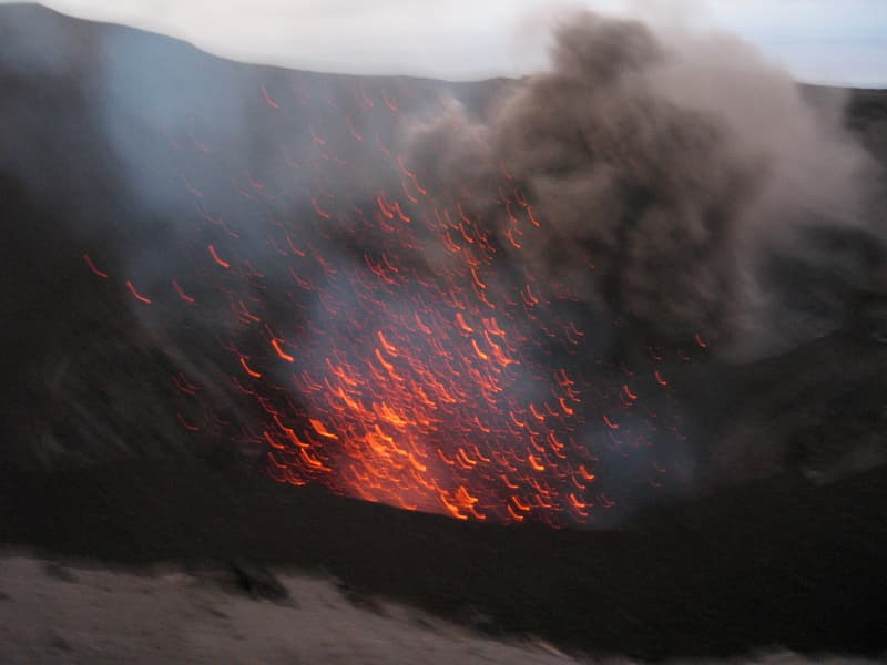
Hunter Island is a stratovolcano rising to 297 meters (974 feet) in France - claimed by Vanuatu's Southwestern Pacific Volcanic Regions. It last erupted in 1903 CE, and volcanologists consider it an active volcanic system. The volcano has produced 6 recorded eruptions.
Geography & Climate
Hunter Island is located in France - claimed by Vanuatu, within the Vanuatu Volcanic Arc of the broader Southwestern Pacific Volcanic Regions. Situated at 22.40° S, 172.05° E in the Southern Hemisphere, the volcano lies within a tropical climate zone. At just 297 meters above sea level, Hunter Island is a relatively low-elevation volcanic feature. Despite its modest height, it remains an active geological formation with the same underlying magmatic processes as its taller counterparts. The volcanic landform is characterized as a composite, which describes the physical shape and structure of the volcanic edifice as observed from the surface.
Geological Context
Hunter Island sits in a subduction zone, where one tectonic plate dives beneath another, creating intense heat and pressure that generates magma. Subduction zones are responsible for many of the world's most explosive volcanoes and deadliest eruptions. For communities in France - claimed by Vanuatu near Hunter Island, this tectonic setting means the volcano is capable of producing powerful explosive eruptions, pyroclastic flows, and lahars that can threaten populated areas within tens of kilometers of the summit. The dominant rock type is andesite / basaltic andesite, a dark, fine-grained volcanic rock that forms from rapidly cooling, low-viscosity lava. Basaltic eruptions tend to be less explosive and produce fluid lava flows that can travel long distances. While less immediately dangerous than explosive eruptions, basaltic lava flows can destroy structures and infrastructure in their path, and volcanic gases released during these eruptions can affect air quality over a wide area.
Eruption History Summary
Hunter Island has 6 recorded eruptions in the geological database, spanning from 1797 CE to 1903 CE. This eruption frequency indicates a moderately active volcanic system with periodic reawakenings. The most recent eruption in 1903 CE places this volcano within the modern era of volcanological observation.
Significance
With 6 recorded eruptions on file, Hunter Island has enough documented activity to help scientists identify patterns in its eruptive behavior.
GVP Reference Summary
Hunter Island, the SE-most volcano of the New Hebrides arc, is a 1-km-wide island consisting of a composite andesitic-to-dacitic cone topped by explosion craters and a lava dome. The island was named after the English trading ship that reported sighting it in 1798. A 100-m-deep, steep-sided crater occupies the NW part of the island, which contrasts with the southern cone, whose summit is filled by a lava dome. Several poorly documented eruptions have been noted since the 19th century. Large streams of lava were reported to be pouring from two craters on the eastern side of the island in 1895; the latest eruption apparently took place from the northern tip. Fumarolic and solfataric areas are located at the northern tip of the island and the NE and SE coasts.
— Smithsonian Institution, Global Volcanism Program
6 Recorded Eruptions
| Year | VEI | Type | Area |
|---|---|---|---|
| 1903 | 0 | Confirmed Eruption | Northern tip of island |
| 1895 | — | Confirmed Eruption | East side |
| 1892 | — | Uncertain Eruption | — |
| 1841 | — | Confirmed Eruption | — |
| 1835 | — | Confirmed Eruption | — |
| 1797 | — | Uncertain Eruption | — |
Real-Time Data
Frequently Asked Questions About Hunter Island
Is Hunter Island an active volcano?+
Yes, Hunter Island is considered an active volcano. Its most recent eruption was in 1903 CE. The volcano is monitored by geological agencies, and its activity status is based on observed eruptions within recorded history.
When did Hunter Island last erupt?+
The most recent recorded eruption of Hunter Island occurred in 1903 CE with a Volcanic Explosivity Index (VEI) of 0. The eruption was classified as a "Confirmed Eruption." Hunter Island has 6 recorded eruptions in total.
How high is Hunter Island?+
Hunter Island has a summit elevation of 297 meters (974 feet) above sea level. At 297 meters, it is a relatively low-elevation volcano.
What type of volcano is Hunter Island?+
Hunter Island is classified as a Stratovolcano. Stratovolcanoes (also called composite volcanoes) are steep, conical volcanoes built up by many layers of hardened lava, tephra, and volcanic ash. They are among the most common and dangerous types, known for explosive eruptions.
Where is Hunter Island located?+
Hunter Island is located in France - claimed by Vanuatu, in the Southwestern Pacific Volcanic Regions. More specifically, it lies within the Vanuatu Volcanic Arc. Its exact coordinates are -22.400° latitude, 172.050° longitude.
Is it safe to visit Hunter Island?+
Visiting Hunter Island requires checking current volcanic activity and alert levels. As an active volcano with eruptions as recent as 1903 CE, conditions can change rapidly. Always consult local geological authorities and follow official warnings before visiting. Many active volcanoes have designated safe viewing areas and guided tour options.