About Loloru
Loloru is a compound rising to 1,887 meters (6,191 feet) in Papua New Guinea's Southwestern Pacific Volcanic Regions. Its last known eruption dates to 1050 BCE, in prehistoric times. The volcano has produced 6 recorded eruptions.
Geography & Climate
Loloru is located in Papua New Guinea, within the Bougainville Volcanic Arc of the broader Southwestern Pacific Volcanic Regions. Situated at 6.52° S, 155.62° E in the Southern Hemisphere, the volcano lies within a tropical climate zone. With a summit elevation of 1,887 meters above sea level, Loloru is a moderately sized peak that remains accessible to hikers and researchers for much of the year. The volcanic landform is characterized as a composite, which describes the physical shape and structure of the volcanic edifice as observed from the surface.
Geological Context
Loloru sits in a subduction zone, where one tectonic plate dives beneath another, creating intense heat and pressure that generates magma. Subduction zones are responsible for many of the world's most explosive volcanoes and deadliest eruptions. For communities in Papua New Guinea near Loloru, this tectonic setting means the volcano is capable of producing powerful explosive eruptions, pyroclastic flows, and lahars that can threaten populated areas within tens of kilometers of the summit. The dominant rock type is andesite / basaltic andesite, a dark, fine-grained volcanic rock that forms from rapidly cooling, low-viscosity lava. Basaltic eruptions tend to be less explosive and produce fluid lava flows that can travel long distances. While less immediately dangerous than explosive eruptions, basaltic lava flows can destroy structures and infrastructure in their path, and volcanic gases released during these eruptions can affect air quality over a wide area.
Eruption History Summary
Loloru has 6 recorded eruptions in the geological database, spanning from 6950 BCE to 1050 BCE. This eruption frequency indicates a moderately active volcanic system with periodic reawakenings.
Significance
With 6 recorded eruptions on file, Loloru has enough documented activity to help scientists identify patterns in its eruptive behavior.
GVP Reference Summary
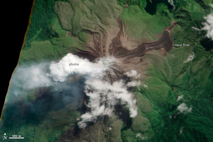
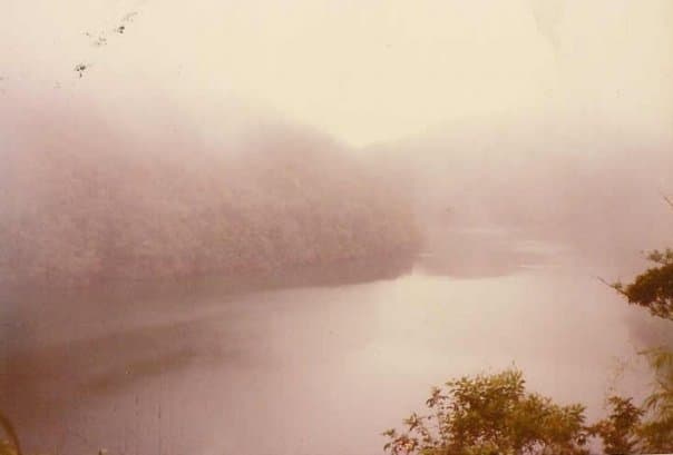
Loloru, the SE-most volcano on Bougainville Island, is the source of a broad ignimbrite apron that covers much of the southern part of the island. The summit consists of two nested calderas, and a forested andesitic lava dome that restricts a crescent-shaped lake to the eastern side of the younger caldera. The smooth flanks of the pyroclastic shield are dissected by radiating deep valleys. A pristine lava flow occurs on the SE flank. Loloru is constructed within the 10 x 15 km Pleistocene Laluai caldera. The topographically higher Taroka group of volcanoes to the NW and the Takuan group to the north also were constructed within the caldera and deflected the bulk of Loloru ignimbrites to the south. The most recent of several major Holocene explosive eruptions took place about 3,000 years ago.
— Smithsonian Institution, Global Volcanism Program
6 Recorded Eruptions
| Year | VEI | Type | Area |
|---|---|---|---|
| 1050 BCE | — | Confirmed Eruption | — |
| 1260 BCE | — | Confirmed Eruption | — |
| 2150 BCE | — | Confirmed Eruption | — |
| 3150 BCE | — | Confirmed Eruption | — |
| 4150 BCE | — | Confirmed Eruption | — |
| 6950 BCE | — | Confirmed Eruption | — |
Real-Time Data
Frequently Asked Questions About Loloru
Is Loloru an active volcano?+
Loloru is not currently classified as active. Its activity evidence is listed as "Eruption Dated." The last known eruption was in 1050 BCE. However, no volcano is ever considered permanently extinct.
When did Loloru last erupt?+
The most recent recorded eruption of Loloru occurred in 1050 BCE. The eruption was classified as a "Confirmed Eruption." Loloru has 6 recorded eruptions in total.
How high is Loloru?+
Loloru has a summit elevation of 1,887 meters (6,191 feet) above sea level. At 1,887 meters, it is a moderately sized volcanic peak, roughly comparable to Mount Vesuvius (1,281m).
What type of volcano is Loloru?+
Loloru is classified as a Compound. Compound volcanoes have distinct geological characteristics that set them apart from other volcanic types.
Where is Loloru located?+
Loloru is located in Papua New Guinea, in the Southwestern Pacific Volcanic Regions. More specifically, it lies within the Bougainville Volcanic Arc. Its exact coordinates are -6.520° latitude, 155.620° longitude.
Is it safe to visit Loloru?+
Loloru can generally be visited, but as with any volcano, visitors should check local conditions and any advisory notices before traveling. Papua New Guinea may have specific regulations for accessing volcanic areas. Guided tours are often the safest and most informative way to experience a volcano.