About Fournaise, Piton de la
Fournaise, Piton de la is a shield rising to 2,632 meters (8,636 feet) in France's Somalian-Antarctic Volcanic Regions. The volcano is currently active, with its most recent eruption in 2023 CE. The volcano has produced 20 recorded eruptions, with a maximum Volcanic Explosivity Index (VEI) of 1.
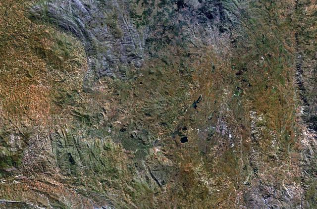
Geography & Climate
Fournaise, Piton de la is located in France, within the Reunion Hotspot Volcano Group of the broader Somalian-Antarctic Volcanic Regions. Situated at 21.24° S, 55.71° E in the Southern Hemisphere, the volcano lies within a tropical climate zone. At 2,632 meters above sea level, Fournaise, Piton de la rises above the surrounding terrain into montane or subalpine conditions. The elevation creates distinct ecological zones along its flanks, from forested lower slopes to exposed rocky terrain near the summit. The volcanic landform is characterized as a shield, which describes the physical shape and structure of the volcanic edifice as observed from the surface.
Geological Context
Fournaise, Piton de la is an intraplate volcano, meaning it formed away from any plate boundary. These volcanoes are often powered by hotspots — plumes of abnormally hot mantle material rising from deep within the Earth. Hotspot volcanoes like Fournaise, Piton de la tend to produce effusive eruptions with lava flows that can be relatively predictable, giving nearby communities in France more time to prepare. However, they can also produce explosive phases, particularly when magma interacts with groundwater. The dominant rock type is basalt / picro-basalt, a dark, fine-grained volcanic rock that forms from rapidly cooling, low-viscosity lava. Basaltic eruptions tend to be less explosive and produce fluid lava flows that can travel long distances. While less immediately dangerous than explosive eruptions, basaltic lava flows can destroy structures and infrastructure in their path, and volcanic gases released during these eruptions can affect air quality over a wide area.
Eruption History Summary
Fournaise, Piton de la has 20 recorded eruptions in the geological database, spanning from 2006 CE to 2023 CE. The most powerful recorded event was a gentle, effusive event in 2009 CE, reaching VEI 1 on the Volcanic Explosivity Index. With an average interval of roughly 1 years between eruptions over a span of 17 years, this is one of the more frequently active volcanoes in the database. This persistent activity suggests a robust and well-supplied magma system beneath the volcano. With eruptive activity as recently as 2023 CE, Fournaise, Piton de la remains an actively monitored volcano.
Significance
Its 20 recorded eruptions make it one of the most prolific volcanoes in our database, reflecting a persistent and well-documented eruptive history that has provided volcanologists with extensive data for understanding eruption patterns and forecasting future activity. Given its recent activity, Fournaise, Piton de la is closely monitored by geological survey organizations to provide early warning of future unrest.
GVP Reference Summary
Piton de la Fournaise is a massive basaltic shield volcano on the French island of Réunion in the western Indian Ocean. Much of its more than 530,000-year history overlapped with eruptions of the deeply dissected Piton des Neiges shield volcano to the NW. Three scarps formed at about 250,000, 65,000, and less than 5,000 years ago by progressive eastward slumping, leaving caldera-sized embayments open to the E and SE. Numerous pyroclastic cones are present on the floor of the scarps and their outer flanks. Most recorded eruptions have originated from the summit and flanks of Dolomieu, a 400-m-high lava shield that has grown within the youngest scarp, which is about 9 km wide and about 13 km from the western wall to the ocean on the E side. More than 150 eruptions, most of which have produced fluid basaltic lava flows, have occurred since the 17th century. Only six eruptions, in 1708, 1774, 1776, 1800, 1977, and 1986, have originated from fissures outside the scarps.
— Smithsonian Institution, Global Volcanism Program
20 Recorded Eruptions
| Year | VEI | Type | Area |
|---|---|---|---|
| 2023 | 0 | Confirmed Eruption | N of Piton Vouvoul |
| 2022 | 0 | Confirmed Eruption | — |
| 2021 | 0 | Confirmed Eruption | Enclos Fouque caldera, 700 m S of Château Fort |
| 2021 | 0 | Confirmed Eruption | S flank of Enclos Fouque, SE of Piton Kala Pélé and SW of Château Fort |
| 2020 | 0 | Confirmed Eruption | E flank of Dolomieu cone between the rim and 2,000 m elevation |
| 2020 | 0 | Confirmed Eruption | WSW flank of Dolomieu cone at elevations between 2,300 and 2,190 m |
| 2019 | 0 | Confirmed Eruption | base of E flank of Dolomieu cone, at the foot of Piton Madoré |
| 2019 | 0 | Confirmed Eruption | SSE flank of Dolomieu cone |
| 2018 | 0 | Confirmed Eruption | N side of Enclos Fouque, just below the rampart at the Nez Coupé de Sainte Rose |
| 2017 | 0 | Confirmed Eruption | 1 km SE of Château Fort and about 2.5 km ENE of Piton de Bert |
| 2017 | 0 | Confirmed Eruption | 750 m E of the Kala-Pélé peak, 850 m W of Château Fort, and 2.2 km NE of Piton de Bert |
| 2016 | 0 | Confirmed Eruption | 1-1.5 km SE of Castle crater |
| 2016 | 0 | Confirmed Eruption | N part of l'Enclos Fouqué caldera, between Puy Mi-côte and July 2015 eruption site |
| 2015 | 0 | Confirmed Eruption | SE of Dolomieu cone, in the Castle crater area |
| 2015 | 0 | Confirmed Eruption | S flank of Dolomieu cone, W of Bory crater |
| 2014 | 0 | Confirmed Eruption | ESE flank of Dolomieu crater |
| 2010 | 0 | Confirmed Eruption | Fissure near Château Fort crater, 1.5 km SE of Dolomieu crater rim |
| 2009 | 1 | Confirmed Eruption | S part of Dolomieu crater, SE and E flanks of Dolomieu cone |
| 2008 | 1 | Confirmed Eruption | W wall of Dolomieu crater |
| 2006 | 1 | Confirmed Eruption | SW and S flanks, Dolomieu cone |
Real-Time Data
Frequently Asked Questions About Fournaise, Piton de la
Is Fournaise, Piton de la an active volcano?+
Yes, Fournaise, Piton de la is considered an active volcano. Its most recent eruption was in 2023 CE. The volcano is monitored by geological agencies, and its activity status is based on observed eruptions within recorded history.
When did Fournaise, Piton de la last erupt?+
The most recent recorded eruption of Fournaise, Piton de la occurred in 2023 CE with a Volcanic Explosivity Index (VEI) of 0. The eruption was classified as a "Confirmed Eruption." Fournaise, Piton de la has 20 recorded eruptions in total.
How high is Fournaise, Piton de la?+
Fournaise, Piton de la has a summit elevation of 2,632 meters (8,636 feet) above sea level. At 2,632 meters, it is comparable in height to many significant mountain peaks and stands well above the tree line.
What type of volcano is Fournaise, Piton de la?+
Fournaise, Piton de la is classified as a Shield. Shield volcanoes have distinct geological characteristics that set them apart from other volcanic types.
Where is Fournaise, Piton de la located?+
Fournaise, Piton de la is located in France, in the Somalian-Antarctic Volcanic Regions. More specifically, it lies within the Reunion Hotspot Volcano Group. Its exact coordinates are -21.244° latitude, 55.708° longitude.
Is it safe to visit Fournaise, Piton de la?+
Visiting Fournaise, Piton de la requires checking current volcanic activity and alert levels. As an active volcano with eruptions as recent as 2023 CE, conditions can change rapidly. Always consult local geological authorities and follow official warnings before visiting. Many active volcanoes have designated safe viewing areas and guided tour options.