About Kostakan
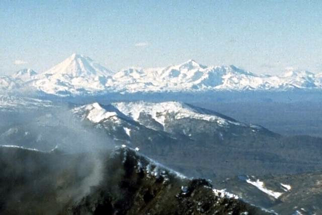
Kostakan is a pyroclastic cone(s) rising to 1,150 meters (3,773 feet) in Russia's Northwestern Pacific Volcanic Regions. Its last known eruption was in 1350 CE. The volcano has produced 6 recorded eruptions, with a maximum Volcanic Explosivity Index (VEI) of 3.
Geography & Climate
Kostakan is located in Russia, within the Eastern Kamchatka Volcanic Arc of the broader Northwestern Pacific Volcanic Regions. Situated at 53.83° N, 158.05° E in the Northern Hemisphere, the volcano lies within a temperate climate zone. With a summit elevation of 1,150 meters above sea level, Kostakan is a moderately sized peak that remains accessible to hikers and researchers for much of the year. The volcanic landform is characterized as a minor (basaltic), which describes the physical shape and structure of the volcanic edifice as observed from the surface.
Geological Context
Kostakan sits in a subduction zone, where one tectonic plate dives beneath another, creating intense heat and pressure that generates magma. Subduction zones are responsible for many of the world's most explosive volcanoes and deadliest eruptions. For communities in Russia near Kostakan, this tectonic setting means the volcano is capable of producing powerful explosive eruptions, pyroclastic flows, and lahars that can threaten populated areas within tens of kilometers of the summit. The dominant rock type is basalt / picro-basalt, a dark, fine-grained volcanic rock that forms from rapidly cooling, low-viscosity lava. Basaltic eruptions tend to be less explosive and produce fluid lava flows that can travel long distances. While less immediately dangerous than explosive eruptions, basaltic lava flows can destroy structures and infrastructure in their path, and volcanic gases released during these eruptions can affect air quality over a wide area.
Eruption History Summary
Kostakan has 6 recorded eruptions in the geological database, spanning from 8050 BCE to 1350 CE. The most powerful recorded event was a severe eruption capable of regional ash fall and pyroclastic flows in 1000 CE, reaching VEI 3 on the Volcanic Explosivity Index. Notable eruptions include 1000 CE (VEI 3), 800 CE (VEI 3), 6550 BCE (VEI 3). This eruption frequency indicates a moderately active volcanic system with periodic reawakenings.
Significance
With a maximum recorded VEI of 3, Kostakan has produced eruptions capable of generating pyroclastic flows and significant ash fall in the surrounding area. While not among the largest eruptions globally, VEI 3 events pose serious hazards to local populations and can disrupt regional air travel. With 6 recorded eruptions on file, Kostakan has enough documented activity to help scientists identify patterns in its eruptive behavior.
GVP Reference Summary
A group of basaltic cinder cones lies south of Bakening volcano, west of the Srednaya Avacha (Middle Avacha) river valley. They are part of a broad zone of regional late Pleistocene to Holocene basaltic volcanism west of the Eastern volcanic zone of Kamchatka that extends from the Kostakan Lake area to the south. Several of the cinder cones are breached by lava flows, some of which extend into the Srednaya Avacha valley. The highest-elevation vent, Zmeya crater, was constructed within a landslide scarp. An unnamed maar is located about 2 km S of Kostakan Lake. Eruptions have occurred during two time periods, between about 11,000 to 7,000 years ago and between about 1,200 and 600 years ago.
— Smithsonian Institution, Global Volcanism Program
6 Recorded Eruptions
| Year | VEI | Type | Area |
|---|---|---|---|
| 1350 | 1 | Confirmed Eruption | Glavny |
| 1200 | 2 | Confirmed Eruption | Glavny |
| 1000 | 3 | Confirmed Eruption | Serpovidny |
| 800 | 3 | Confirmed Eruption | Maar S of Lake Kostakan, Krasny cone |
| 6550 BCE | 3 | Confirmed Eruption | Ochkovy |
| 8050 BCE | 3 | Confirmed Eruption | Domashnii |
Real-Time Data
Frequently Asked Questions About Kostakan
Is Kostakan an active volcano?+
Kostakan is not currently classified as active. Its activity evidence is listed as "Eruption Dated." The last known eruption was in 1350 CE. However, no volcano is ever considered permanently extinct.
When did Kostakan last erupt?+
The most recent recorded eruption of Kostakan occurred in 1350 CE with a Volcanic Explosivity Index (VEI) of 1. The eruption was classified as a "Confirmed Eruption." Kostakan has 6 recorded eruptions in total.
How high is Kostakan?+
Kostakan has a summit elevation of 1,150 meters (3,773 feet) above sea level. At 1,150 meters, it is a moderately sized volcanic peak, roughly comparable to Mount Vesuvius (1,281m).
What type of volcano is Kostakan?+
Kostakan is classified as a Pyroclastic cone(s). Pyroclastic cones (or cinder cones) are small, steep-sided volcanic cones built from fragments of lava blasted into the air. They are the simplest type of volcano and often form in groups.
Where is Kostakan located?+
Kostakan is located in Russia, in the Northwestern Pacific Volcanic Regions. More specifically, it lies within the Eastern Kamchatka Volcanic Arc. Its exact coordinates are 53.833° latitude, 158.052° longitude.
Is it safe to visit Kostakan?+
Kostakan can generally be visited, but as with any volcano, visitors should check local conditions and any advisory notices before traveling. Russia may have specific regulations for accessing volcanic areas. Guided tours are often the safest and most informative way to experience a volcano.