About Llullaillaco
Llullaillaco is a stratovolcano rising to 6,739 meters (22,111 feet) in Chile-Argentina's South America Volcanic Regions. Its last known eruption was in 1877 CE. The volcano has produced 3 recorded eruptions, with a maximum Volcanic Explosivity Index (VEI) of 2.
Geography & Climate
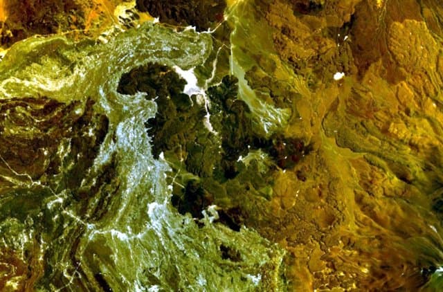
Llullaillaco is located in Chile-Argentina, within the Central Andean Volcanic Arc of the broader South America Volcanic Regions. Situated at 24.72° S, 68.53° W in the Southern Hemisphere, the volcano lies within a subtropical climate zone. At 6,739 meters above sea level, Llullaillaco reaches well into the permanent snow and ice zone. Glaciers and snowpack on the upper slopes create the potential for lahars — destructive volcanic mudflows — during eruptions, as heat rapidly melts ice and snow. The volcanic landform is characterized as a composite, which describes the physical shape and structure of the volcanic edifice as observed from the surface.
Geological Context
Llullaillaco sits in a subduction zone, where one tectonic plate dives beneath another, creating intense heat and pressure that generates magma. Subduction zones are responsible for many of the world's most explosive volcanoes and deadliest eruptions. For communities in Chile-Argentina near Llullaillaco, this tectonic setting means the volcano is capable of producing powerful explosive eruptions, pyroclastic flows, and lahars that can threaten populated areas within tens of kilometers of the summit. The dominant rock type is dacite, an intermediate to silica-rich volcanic rock. This composition typically produces more viscous magma, leading to more explosive eruptions with ash columns and pyroclastic flows. Andesitic and dacitic magmas build pressure before erupting, which is why volcanoes with this rock chemistry are often associated with Plinian-style eruptions that can send ash tens of kilometers into the atmosphere and disrupt aviation across entire regions.
Eruption History Summary
Llullaillaco has 3 recorded eruptions in the geological database, spanning from 1854 CE to 1877 CE. The most powerful recorded event was an explosive event producing ash plumes up to several kilometers in 1877 CE, reaching VEI 2 on the Volcanic Explosivity Index. These eruptions span roughly 23 years of volcanic history.
GVP Reference Summary
The world's highest historically active volcano, Llullaillaco sits astride the Chile-Argentina border. The summit is formed by a smaller well-preserved cone that was constructed on an older Pleistocene edifice. A major debris-avalanche deposit produced by collapse of the older volcano about 150,000 years ago extends eastward into Argentina and diverges around the N and S sides of the older Cerro Rosado stratovolcano 17 km to the E. Construction of several lava domes and flows was associated with growth of the modern cone. The two most prominent flows contain distinct flow levees and ridges and extend down the N and S flanks. These two extremely youthful-looking dacitic flows were initially considered to be of Holocene age, but more recent Ar/Ar dating indicates that they are of late Pleistocene age (Richards and Villeneuve, 2001). Two explosive eruptions and another that may have included lava effusion were reported in the 19th century.
— Smithsonian Institution, Global Volcanism Program
3 Recorded Eruptions
| Year | VEI | Type | Area |
|---|---|---|---|
| 1877 | 2 | Confirmed Eruption | — |
| 1868 | 0 | Confirmed Eruption | — |
| 1854 | 2 | Confirmed Eruption | — |
Real-Time Data
Frequently Asked Questions About Llullaillaco
Is Llullaillaco an active volcano?+
Llullaillaco is classified as active based on credible evidence of past eruptions. Although its last known eruption was in 1877 CE, volcanologists consider it capable of erupting again.
When did Llullaillaco last erupt?+
The most recent recorded eruption of Llullaillaco occurred in 1877 CE with a Volcanic Explosivity Index (VEI) of 2. The eruption was classified as a "Confirmed Eruption." Llullaillaco has 3 recorded eruptions in total.
How high is Llullaillaco?+
Llullaillaco has a summit elevation of 6,739 meters (22,111 feet) above sea level. This makes it one of the tallest volcanoes in the world, comparable in height to some of the highest peaks in the Andes.
What type of volcano is Llullaillaco?+
Llullaillaco is classified as a Stratovolcano. Stratovolcanoes (also called composite volcanoes) are steep, conical volcanoes built up by many layers of hardened lava, tephra, and volcanic ash. They are among the most common and dangerous types, known for explosive eruptions.
Where is Llullaillaco located?+
Llullaillaco is located in Chile-Argentina, in the South America Volcanic Regions. More specifically, it lies within the Central Andean Volcanic Arc. Its exact coordinates are -24.720° latitude, -68.530° longitude.
Is it safe to visit Llullaillaco?+
Llullaillaco can generally be visited, but as with any volcano, visitors should check local conditions and any advisory notices before traveling. Chile-Argentina may have specific regulations for accessing volcanic areas. Guided tours are often the safest and most informative way to experience a volcano.