About Marsabit
Marsabit is a shield rising to 1,707 meters (5,601 feet) in Kenya's Eastern Africa Volcanic Regions. No historical eruptions have been recorded, though the volcano is classified based on geological evidence of past activity.
Geography & Climate
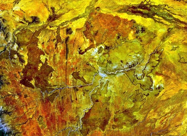
Marsabit is located in Kenya, within the Kenyan Rift Volcanic Province of the broader Eastern Africa Volcanic Regions. Situated at 2.32° N, 37.97° E in the Northern Hemisphere, the volcano lies within a tropical climate zone. With a summit elevation of 1,707 meters above sea level, Marsabit is a moderately sized peak that remains accessible to hikers and researchers for much of the year. The volcanic landform is characterized as a shield, which describes the physical shape and structure of the volcanic edifice as observed from the surface.
Geological Context
Marsabit is situated along a rift zone, where tectonic plates are pulling apart. As the crust thins and fractures, magma rises to fill the gap, creating volcanic activity. Rift volcanism typically produces more fluid lava flows rather than explosive blasts, which means communities near Marsabit in Kenya generally face slower-moving hazards like lava flows and ground fissures rather than sudden pyroclastic events. However, rift volcanoes can still generate significant ash emissions and gas releases that affect local air quality. The dominant rock type is basalt / picro-basalt, a dark, fine-grained volcanic rock that forms from rapidly cooling, low-viscosity lava. Basaltic eruptions tend to be less explosive and produce fluid lava flows that can travel long distances. While less immediately dangerous than explosive eruptions, basaltic lava flows can destroy structures and infrastructure in their path, and volcanic gases released during these eruptions can affect air quality over a wide area.
GVP Reference Summary
Marsabit is a massive basaltic shield volcano located 170 km E off the center of the East African Rift. There are 22 maars and 180 cinder cones on its slopes, most of which are concentrated along NW- and NE-trending belts that cut across the thickly vegetated summit region. The main phase of shield construction occurred during the Pliocene. Quaternary activity shifted to explosive activity that formed maars accompanied by further extensive effusion of lava flows. The youngest dated lava flow has a Potassium-Argon age of 68,000 +/- 16,000 years, but more recent activity has also occurred. The youngest lava flows are unvegetated, and Key (1987) mapped the post-shield cinder cones as Pleistocene-to-Recent in age.
— Smithsonian Institution, Global Volcanism Program
0 Recorded Eruptions
No eruption records available for Marsabit.
Real-Time Data
Frequently Asked Questions About Marsabit
Is Marsabit an active volcano?+
Marsabit is not currently classified as active. Its activity evidence is listed as "Evidence Uncertain." No recorded eruptions have been documented. However, no volcano is ever considered permanently extinct.
How high is Marsabit?+
Marsabit has a summit elevation of 1,707 meters (5,601 feet) above sea level. At 1,707 meters, it is a moderately sized volcanic peak, roughly comparable to Mount Vesuvius (1,281m).
What type of volcano is Marsabit?+
Marsabit is classified as a Shield. Shield volcanoes have distinct geological characteristics that set them apart from other volcanic types.
Where is Marsabit located?+
Marsabit is located in Kenya, in the Eastern Africa Volcanic Regions. More specifically, it lies within the Kenyan Rift Volcanic Province. Its exact coordinates are 2.320° latitude, 37.970° longitude.
Is it safe to visit Marsabit?+
Marsabit can generally be visited, but as with any volcano, visitors should check local conditions and any advisory notices before traveling. Kenya may have specific regulations for accessing volcanic areas. Guided tours are often the safest and most informative way to experience a volcano.