About Rota
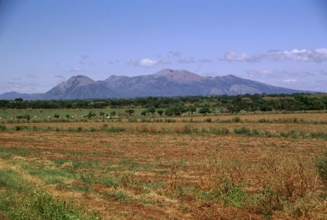
Rota is a stratovolcano rising to 832 meters (2,730 feet) in Nicaragua's Middle America-Caribbean Volcanic Regions. No historical eruptions have been recorded, though the volcano is classified based on geological evidence of past activity.
Geography & Climate
Rota is located in Nicaragua, within the Central America Volcanic Arc of the broader Middle America-Caribbean Volcanic Regions. Situated at 12.55° N, 86.75° W in the Northern Hemisphere, the volcano lies within a tropical climate zone. With a summit elevation of 832 meters above sea level, Rota is a moderately sized peak that remains accessible to hikers and researchers for much of the year. The volcanic landform is characterized as a composite, which describes the physical shape and structure of the volcanic edifice as observed from the surface.
GVP Reference Summary
The deeply eroded, forested Rota stratovolcano is located between Cerro Negro and the Telica volcanic complex in the central Marrabios Range. The volcano, also known as Orota, is truncated by a 1-km-wide circular crater whose rim is lowest on the southern side. The latest eruption produced thick andesitic lava flows from a NE-trending fissure NW of the summit. Seismic swarms occurred in 1986, 1989, and 1992, but may have been related to regional fracture systems rather than a magmatic system. Two small NNW-SSE-trending lava domes, El Bosque (also known as Lomas San Ignacio del Bosque or Cerro Ojochal) are located on the plain 2 km N. They were constructed along the same trend as other eruptive fissures that extend transverse to the Marrabios Range volcanoes. An extensive lava field in this area was erupted from numerous small cones and maars.
— Smithsonian Institution, Global Volcanism Program
0 Recorded Eruptions
No eruption records available for Rota.
Real-Time Data
Frequently Asked Questions About Rota
Is Rota an active volcano?+
Rota is not currently classified as active. Its activity evidence is listed as "unknown." No recorded eruptions have been documented. However, no volcano is ever considered permanently extinct.
How high is Rota?+
Rota has a summit elevation of 832 meters (2,730 feet) above sea level. At 832 meters, it is a relatively low-elevation volcano.
What type of volcano is Rota?+
Rota is classified as a Stratovolcano. Stratovolcanoes (also called composite volcanoes) are steep, conical volcanoes built up by many layers of hardened lava, tephra, and volcanic ash. They are among the most common and dangerous types, known for explosive eruptions.
Where is Rota located?+
Rota is located in Nicaragua, in the Middle America-Caribbean Volcanic Regions. More specifically, it lies within the Central America Volcanic Arc. Its exact coordinates are 12.550° latitude, -86.750° longitude.
Is it safe to visit Rota?+
Rota can generally be visited, but as with any volcano, visitors should check local conditions and any advisory notices before traveling. Nicaragua may have specific regulations for accessing volcanic areas. Guided tours are often the safest and most informative way to experience a volcano.