About Conchagua
Conchagua is a stratovolcano rising to 1,225 meters (4,019 feet) in El Salvador's Middle America-Caribbean Volcanic Regions. No historical eruptions have been recorded, though the volcano is classified based on geological evidence of past activity.
Geography & Climate
Conchagua is located in El Salvador, within the Central America Volcanic Arc of the broader Middle America-Caribbean Volcanic Regions. Situated at 13.28° N, 87.84° W in the Northern Hemisphere, the volcano lies within a tropical climate zone. With a summit elevation of 1,225 meters above sea level, Conchagua is a moderately sized peak that remains accessible to hikers and researchers for much of the year. The volcanic landform is characterized as a composite, which describes the physical shape and structure of the volcanic edifice as observed from the surface.
GVP Reference Summary
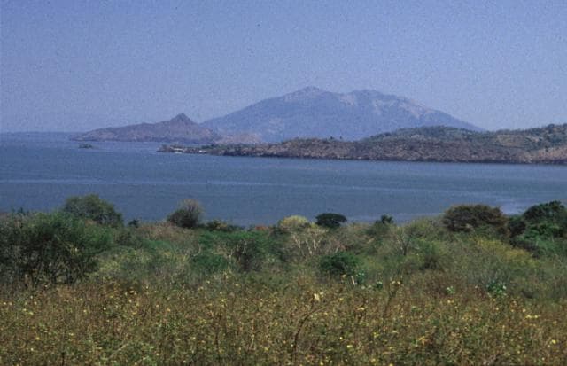
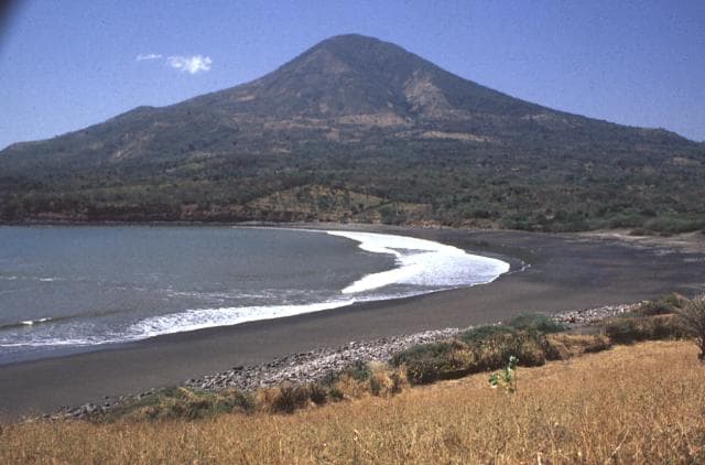
Conchagua (also known as Cochague) is a conical edifice consisting of two overlapping stratovolcanoes, Ocotal and Banderas, overlooking the Gulf of Fonseca at the SE tip of El Salvador. It is elongated WSW-ENE, and the eastern and southern flanks descend into the sea. Cerro de La Banderas has a large horseshoe-shaped crater open to the NE, and though it appears younger, Ar-Ar dating by Quezada and Garcia (2008) was 0.41 +/- 0.1 Ma. To the WSW, the slightly higher Cerro del Ocotal, at 1225 m, was dated at 0.15 +/- 0.02 Ma. Ocotal has multiple peaks and the flanks are more dissected. Eruptions reported for the years 1522, 1688, 1868, 1892, and 1947 are erroneous, and may refer to landslides associated with earthquakes, an interpretation supported by Rapprich et al. (2010).
— Smithsonian Institution, Global Volcanism Program
0 Recorded Eruptions
No eruption records available for Conchagua.
Real-Time Data
Frequently Asked Questions About Conchagua
Is Conchagua an active volcano?+
Conchagua is not currently classified as active. Its activity evidence is listed as "unknown." No recorded eruptions have been documented. However, no volcano is ever considered permanently extinct.
How high is Conchagua?+
Conchagua has a summit elevation of 1,225 meters (4,019 feet) above sea level. At 1,225 meters, it is a moderately sized volcanic peak, roughly comparable to Mount Vesuvius (1,281m).
What type of volcano is Conchagua?+
Conchagua is classified as a Stratovolcano. Stratovolcanoes (also called composite volcanoes) are steep, conical volcanoes built up by many layers of hardened lava, tephra, and volcanic ash. They are among the most common and dangerous types, known for explosive eruptions.
Where is Conchagua located?+
Conchagua is located in El Salvador, in the Middle America-Caribbean Volcanic Regions. More specifically, it lies within the Central America Volcanic Arc. Its exact coordinates are 13.275° latitude, -87.845° longitude.
Is it safe to visit Conchagua?+
Conchagua can generally be visited, but as with any volcano, visitors should check local conditions and any advisory notices before traveling. El Salvador may have specific regulations for accessing volcanic areas. Guided tours are often the safest and most informative way to experience a volcano.