About Tres Virgenes
Tres Virgenes is a stratovolcano(es) rising to 1,934 meters (6,345 feet) in Mexico's Eastern Pacific Volcanic Regions. No historical eruptions have been recorded, though the volcano is classified based on geological evidence of past activity. The volcano has produced 2 recorded eruptions.
Geography & Climate
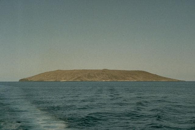
Tres Virgenes is located in Mexico, within the Gulf of California Rift Volcanic Province of the broader Eastern Pacific Volcanic Regions. Situated at 27.47° N, 112.59° W in the Northern Hemisphere, the volcano lies within a subtropical climate zone. With a summit elevation of 1,934 meters above sea level, Tres Virgenes is a moderately sized peak that remains accessible to hikers and researchers for much of the year. The volcanic landform is characterized as a composite, which describes the physical shape and structure of the volcanic edifice as observed from the surface.
Eruption History Summary
Tres Virgenes has 2 recorded eruptions in the geological database, spanning from 1746 CE to 1857 CE. These eruptions span roughly 111 years of volcanic history.
GVP Reference Summary
The Tres Vírgenes volcanic complex contains the only large stratovolcanoes in Baja California, rising above the Gulf of California in the east-central part of the peninsula. Three volcanoes, El Viejo, El Azufre, and La Vírgen, constructed along a NE-SW line, are progressively younger to the SW. The youngest, La Vírgen, is a stratovolcano with both dacitic and andesitic flank lava domes and lava flows. A major Plinian eruption from a SW-flank vent was radiocarbon dated at about 6,500 years, but Helium exposure and Uranium-series dates give a Pleistocene age (30.7 ka) for this event (Schmitt et al., 2006). A stratigraphic review (Avellan et al., 2018) noted that the 30.7 ka age is closer to the expected age of the tephra fall, and that the 22-25.5 ka (as determined by Schmitt et al., 2006) andesitic-dacitic lava flows dispersed around the cone are the youngest units in the complex. Although an ash plume from Tres Vírgenes was reported in 1746 by a Spanish Jesuit priest while navigating the Gulf of California, no tephra deposits from such a recent eruption have been found. A geothermal plant is located at the northern end of the complex near the margin of the Pleistocene El Aguajito caldera.
— Smithsonian Institution, Global Volcanism Program
2 Recorded Eruptions
| Year | VEI | Type | Area |
|---|---|---|---|
| 1857 | — | Uncertain Eruption | — |
| 1746 | — | Uncertain Eruption | — |
Real-Time Data
Frequently Asked Questions About Tres Virgenes
Is Tres Virgenes an active volcano?+
Tres Virgenes is not currently classified as active. Its activity evidence is listed as "unknown." No recorded eruptions have been documented. However, no volcano is ever considered permanently extinct.
When did Tres Virgenes last erupt?+
The most recent recorded eruption of Tres Virgenes occurred in 1857 CE. The eruption was classified as a "Uncertain Eruption." Tres Virgenes has 2 recorded eruptions in total.
How high is Tres Virgenes?+
Tres Virgenes has a summit elevation of 1,934 meters (6,345 feet) above sea level. At 1,934 meters, it is a moderately sized volcanic peak, roughly comparable to Mount Vesuvius (1,281m).
What type of volcano is Tres Virgenes?+
Tres Virgenes is classified as a Stratovolcano(es). Stratovolcano(es) volcanoes have distinct geological characteristics that set them apart from other volcanic types.
Where is Tres Virgenes located?+
Tres Virgenes is located in Mexico, in the Eastern Pacific Volcanic Regions. More specifically, it lies within the Gulf of California Rift Volcanic Province. Its exact coordinates are 27.470° latitude, -112.591° longitude.
Is it safe to visit Tres Virgenes?+
Tres Virgenes can generally be visited, but as with any volcano, visitors should check local conditions and any advisory notices before traveling. Mexico may have specific regulations for accessing volcanic areas. Guided tours are often the safest and most informative way to experience a volcano.