Uinkaret Field
Volcanic field · 1,555m · United States
About Uinkaret Field
Uinkaret Field is a volcanic field rising to 1,555 meters (5,102 feet) in United States's North America Volcanic Regions. Its last known eruption was in 1100 CE. The volcano has produced 1 recorded eruption, with a maximum Volcanic Explosivity Index (VEI) of 1.
Geography & Climate
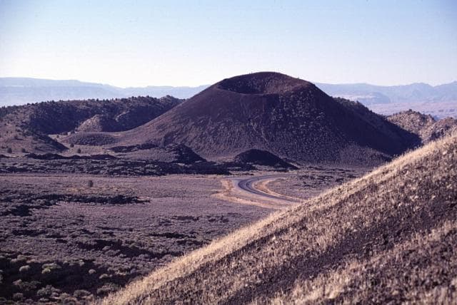
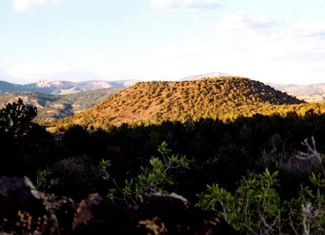
Uinkaret Field is located in United States, within the Basin and Range Volcanic Province of the broader North America Volcanic Regions. Situated at 36.38° N, 113.13° W in the Northern Hemisphere, the volcano lies within a temperate climate zone. With a summit elevation of 1,555 meters above sea level, Uinkaret Field is a moderately sized peak that remains accessible to hikers and researchers for much of the year. The volcanic landform is characterized as a cluster, which describes the physical shape and structure of the volcanic edifice as observed from the surface.
Geological Context
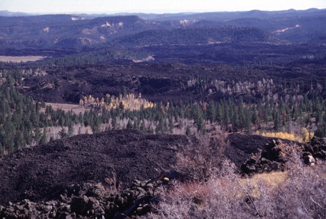
Uinkaret Field is situated along a rift zone, where tectonic plates are pulling apart. As the crust thins and fractures, magma rises to fill the gap, creating volcanic activity. Rift volcanism typically produces more fluid lava flows rather than explosive blasts, which means communities near Uinkaret Field in United States generally face slower-moving hazards like lava flows and ground fissures rather than sudden pyroclastic events. However, rift volcanoes can still generate significant ash emissions and gas releases that affect local air quality. The dominant rock type is trachybasalt / tephrite basanite, a dark, fine-grained volcanic rock that forms from rapidly cooling, low-viscosity lava. Basaltic eruptions tend to be less explosive and produce fluid lava flows that can travel long distances. While less immediately dangerous than explosive eruptions, basaltic lava flows can destroy structures and infrastructure in their path, and volcanic gases released during these eruptions can affect air quality over a wide area.
Eruption History Summary
Uinkaret Field has 1 recorded eruption in the geological database, spanning from 1100 CE to 1100 CE. The most powerful recorded event was a gentle, effusive event in 1100 CE, reaching VEI 1 on the Volcanic Explosivity Index.
GVP Reference Summary
The Uinkaret volcanic field straddling the Grand Canyon contains cinder cones that have produced lava flows that repeatedly cascaded into the Grand Canyon, forming temporary lava dams up to 200 m high. Two of the most prominent landmarks are Vulcan's Throne, a cinder cone on the north rim, and Vulcan's Forge, a small volcanic neck erupted within the Colorado River, 1000 m below. Most of the field lies north of the Grand Canyon on the Uinkaret Plateau between the Toroweap and Hurricane faults. It is largely Pleistocene in age, and Vulcan's Throne has a cosmogenic helium age of about 73,000 years. Volcanic activity has continued into the Holocene. One lava flow, from Little Springs, south of Pliocene Mount Trumbull, has a cosmogenic helium age of 1300 +/- 500 years BP. Pottery sherds dated at between 1050 and 1200 CE were found within the Little Springs lava flow, which occurred about the same time as the Sunset Crater eruption in the San Francisco volcanic field to the SE.
— Smithsonian Institution, Global Volcanism Program
1 Recorded Eruption
| Year | VEI | Type | Area |
|---|---|---|---|
| 1100 | 1 | Confirmed Eruption | Little Springs |
Real-Time Data
Frequently Asked Questions About Uinkaret Field
Is Uinkaret Field an active volcano?+
Uinkaret Field is not currently classified as active. Its activity evidence is listed as "Eruption Dated." The last known eruption was in 1100 CE. However, no volcano is ever considered permanently extinct.
When did Uinkaret Field last erupt?+
The most recent recorded eruption of Uinkaret Field occurred in 1100 CE with a Volcanic Explosivity Index (VEI) of 1. The eruption was classified as a "Confirmed Eruption." Uinkaret Field has 1 recorded eruption in total.
How high is Uinkaret Field?+
Uinkaret Field has a summit elevation of 1,555 meters (5,102 feet) above sea level. At 1,555 meters, it is a moderately sized volcanic peak, roughly comparable to Mount Vesuvius (1,281m).
What type of volcano is Uinkaret Field?+
Uinkaret Field is classified as a Volcanic field. Volcanic fields consist of clusters of small volcanic vents and cinder cones spread across a region. Rather than a single central vent, eruptions can occur at many points across the field.
Where is Uinkaret Field located?+
Uinkaret Field is located in United States, in the North America Volcanic Regions. More specifically, it lies within the Basin and Range Volcanic Province. Its exact coordinates are 36.380° latitude, -113.130° longitude.
Is it safe to visit Uinkaret Field?+
Uinkaret Field can generally be visited, but as with any volcano, visitors should check local conditions and any advisory notices before traveling. United States may have specific regulations for accessing volcanic areas. Guided tours are often the safest and most informative way to experience a volcano.